
By N. H. Gill
July 23, 2020
Martín de Murúa was a Basque Mercedarian friar who wrote the Historia General del Piru (c.1580-1616), an illustrated history of what are today the South American nations of Colombia, Ecuador, Peru, and Bolivia. Murúa arrived in Peru in the early 1580s and traveled extensively as a missionary and translator of Quechua and Spanish in the Cuzco-Lake Titicaca region.
In this drawing of Murúa by indigenous artist Felipe Guaman Poma, the friar is depicted beating an indigenous weaver. Guaman Poma had worked with Murúa, providing some of the illustrations for his book, but he had a falling out with the priest and went on to write his own illustrated history of Peru in 1616, in part to correct what he saw as Murúa’s errors.

“Son tan brabos y justicieros y maltrata a los yndios y haze trauajar con un palo en este rreyno en las dotrinas, no ay rremedio.”
GKS 2232 4º: Guaman Poma, Nueva corónica y buen gobierno, Drawing 258 (1615)
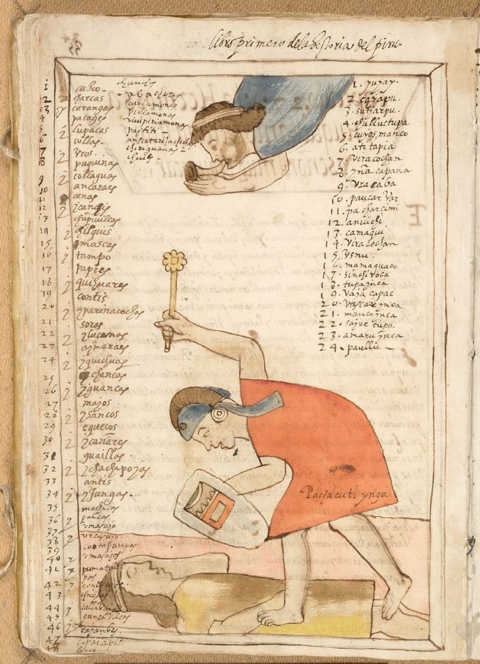
While Murúa’s Historia General del Piru, known as the Getty Murúa, is the final edition of his work, the lesser-known Galvin Murúa, an incomplete version published in 1590, contains several images not included in the final copy, including this one of Pachacuti Ynga clubbing a fallen soldier while an angel with a horn flies above. Accompanying the image is a list of places and communities conquered by the Incas.
By plotting the fifty sites identifiable through toponyms or other ethnohistorical data, a clear preference emerged for highland river valleys at an average elevation of 2,800 meters above sea level. Overall, three-quarters of the sites were located in the highlands, nine in the upper Amazon, and two on the Pacific coast. Of the highland sites, most settlements were located around 3,000 meters, suggesting settlements were built slightly above their prime agricultural fields.

According to historian Chantal Caillavet, maize crops in the northern Andes have the highest yields in the relatively warmer valleys of the sierra, between roughly 1,700 meters to 2,500 meters, with the lower, well-watered areas producing much more.[1]
This pattern can also be seen in the location of the most important Incan centers outside of Cuzco – Cajamarca, Tomebamba, Quito, and Carangui – which were all located between 2,225 meters and 2,850 meters above sea level.[2]
While unsurprising, the mapping exercise supports our understanding of the Incas as a culture organized around the well-watered maize lands that fueled their economic and military expansion. As such, controlling these areas represented a strategic objective similar much the same as gaining access to crude-oil became an imperative for nation-states in the twentieth century.
[1] Chantal Caillavet, “A Native American System of Wetland Agriculture in Different Ecosystems in the Ecuadorian Andes (15th-18th Centuries),” Environment and History 14, no. 3 (August 1, 2008): 340, https://doi.org/10.3197/096734008X333554.
[2] Cajamarca: 2,750m; Cuenca: 2,550m; Quito: 2,850m; Ibarra: 2,225m.
